LIVE INTERACTIVE UK FLOOD ALERTS
Interactive Map, History, and Future Outlook for Flooding in the UK

| Location | Severity | Action |
|---|

UK Flood Alerts: Interactive Map, History, and Future Outlook
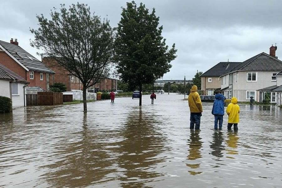
Flooding remains a significant challenge across the United Kingdom, with unpredictable weather patterns and rising water levels posing risks to homes, businesses, and infrastructure. For residents and authorities alike, staying informed about UK flood alerts is critical to managing these risks effectively. In this article, we explore an innovative interactive flood map that provides live updates on the flood situation across the UK, delve into the nation’s history of flooding, and look ahead to what the future might hold. Whether you're searching for real-time flood warnings UK or seeking to understand flood patterns, this guide has you covered.
Interactive Flood Map: Real-Time UK Flood Alerts
Imagine having access to a tool that shows you exactly where flooding is happening in the UK, updated every 15 minutes. Our interactive flood map UK, powered by data from the Environment Agency, does just that. Using two key API calls, for flood area coordinates and for active flood risks with a minimum severity level of 3, this map plots flood-prone areas across a dynamic interface built with Leaflet.js.
The map is paired with a table featuring three columns: Location, Severity, and Action. The Action column includes a clickable map pin icon that zooms the map to the affected location and displays either a detailed message (if available) or the severity level. A status bar appears during data loading to ensure users know the map is processing the latest information. This tool is invaluable for anyone needing live flood updates UK, from emergency responders to homeowners checking their local flood risk UK.
A Brief History of Flooding in the UK
Flooding is not a new phenomenon in the UK. Records dating back to 1946, when predecessor bodies to the Environment Agency began systematically documenting incidents, reveal a long history of water-related challenges. One of the most infamous events was the North Sea Flood of 1953, which claimed over 300 lives in the UK and flooded vast swathes of the east coast. More recently, the winter of 2013-2014 saw unprecedented rainfall, with the River Thames bursting its banks and submerging parts of southern England.
The Historic Flood Map, a GIS layer maintained by the Environment Agency, shows the maximum extent of past floods from rivers, seas, and groundwater springs. While it doesn’t cover every incident, surface water flooding data is often excluded unless fluvial sources dominate, it highlights how flood patterns have evolved. Climate change and urban development have altered these patterns, meaning some areas that once escaped flooding are now at risk, while others may be better protected by modern defenses.
The Outlook for UK Flooding
Looking ahead, the UK flood outlook is shaped by several factors: climate change, rising sea levels, and increased rainfall intensity. The Met Office and Environment Agency predict that wetter winters and more extreme weather events will heighten flood risks, particularly in low-lying areas and along major rivers like the Severn, Thames, and Trent. The government’s “Check for Flooding” service offers a five-day flood forecast, but long-term planning is crucial.
Experts suggest that flood defenses alone won’t suffice. Sustainable drainage systems, reforestation, and wetland restoration are gaining traction as proactive measures to mitigate flood risk UK. Meanwhile, tools like our real-time flood alerts UK map empower communities to respond swiftly, reducing damage and disruption. As climate patterns shift, staying ahead of flooding will require both innovation and vigilance.
AI-Generated Insights: How This Article and Map Were Created
This article and the accompanying interactive flood map were crafted with the assistance of AI technology, specifically Grok 3, developed by xAI. The map’s code leverages modern JavaScript with private class fields for secure, efficient data handling, while the article’s content was tailored for SEO using targeted keywords like UK flood alerts and flood warnings UK. By combining real-time data from the Environment Agency with AI-driven design, we’ve created a resource that’s both practical and accessible. This fusion of technology and information underscores the potential of AI to enhance our understanding and management of natural events like flooding.